
Walworth County buyer guide
Buying a Waterfront Home in Walworth County: A Due-Diligence Guide
The view is only one part of the property. Before closing, understand which authority regulates the parcel, what records exist, and whether your plans fit the shoreline, structures, utilities, and site.
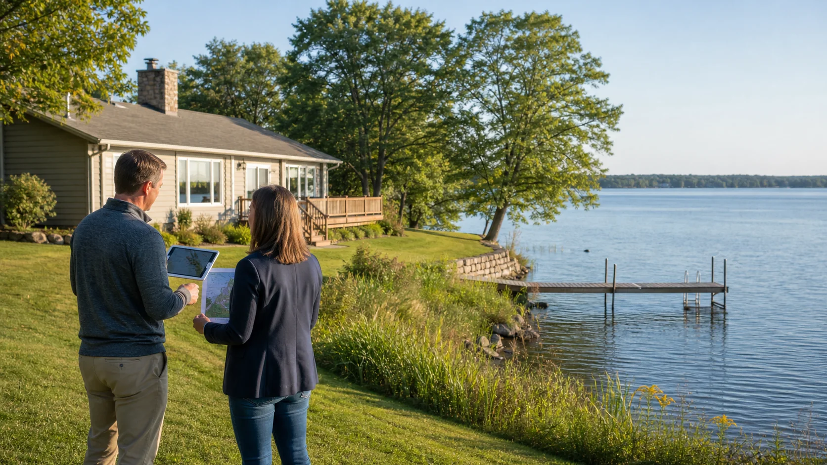
Waterfront property can combine a home, shoreline, pier, water access, drainage, vegetation, and several layers of regulation. Buyers comparing properties in Lake Geneva, Fontana-on-Geneva Lake, Williams Bay, Delavan, or elsewhere in Walworth County should investigate the specific parcel rather than assuming the rules or conditions are the same around every lake.
This checklist organizes the questions. It does not determine whether a structure is legal, promise that a permit will be issued, or replace advice from zoning officials, inspectors, surveyors, engineers, insurers, lenders, or attorneys.
Identify the governing municipality and zoning authority
Begin with the parcel number and legal description, not only the mailing address. A Lake Geneva postal address, for example, does not by itself establish which city, village, town, or county office has jurisdiction. Walworth County states that its general zoning code applies to unincorporated land except the Town of Bloomfield, and that its shoreland zoning code covers specified unincorporated lands near navigable water. Cities and villages administer their own requirements.
Use Walworth County's land-information resources to review parcel, zoning, address, shoreland, floodplain, and wetland layers. Treat an online map as a research starting point. Ask the responsible zoning office to confirm the current classification, required setbacks, recorded approvals, and whether a proposed use needs a permit, variance, or other review.
Understand where shoreland rules may apply
Wisconsin's shoreland management program applies minimum standards to unincorporated land within 1,000 feet of a navigable lake, pond, or flowage, or within 300 feet of a navigable stream or the landward side of its floodplain, whichever is greater. Walworth County describes comparable shoreland jurisdiction for unincorporated parcels. Exact application depends on the property and the responsible authority.
Shoreland rules can affect setbacks, vegetation, impervious surfaces, lot configuration, grading, and construction. A house that exists today may be legal but nonconforming under current standards. That does not automatically make it defective, but it can affect an addition, deck, garage, reconstruction, or major remodeling plan. Ask for a written zoning history when future changes are important to the purchase.
Verify structures, improvements, and permits
Request permits and approvals for the house, additions, decks, accessory buildings, retaining walls, shoreline work, grading, wells, septic systems, and other visible improvements. Compare those records with what is actually on the site. An assessor sketch or online map is not a substitute for permits or a survey.
If the property has a pier, boat shelter, riprap, seawall, steps, beach material, or other work near or below the ordinary high water mark, ask who installed it and what authorization applies. The Wisconsin Department of Natural Resources explains that it generally regulates activities below the ordinary high water mark and certain work in wetlands, while local governments regulate setbacks and activities above that mark. Some projects may qualify for exemptions; others require state, local, or federal review.
Do not assume water access and pier use from appearance alone
A visible path or pier does not establish ownership, riparian rights, permanent placement rights, or permission for a particular configuration. Review the deed, survey, title documents, easements, subdivision restrictions, association documents, and available permits. If access is shared, determine who may use it, who maintains it, how expenses are allocated, and whether boat slips or watercraft use are assigned.
Questions about the ordinary high water mark, navigability, lakebed rights, easements, and access can be legally significant. Use qualified survey and legal professionals when documents or boundaries are unclear rather than relying on landscaping, fences, or the seller's informal understanding.
Inspect the shoreline and site as systems
Walk the property with attention to erosion, unstable slopes, standing water, drainage toward the house, retaining-wall movement, exposed roots, sediment, shoreline armoring, and evidence of recent fill or grading. Note where roof and surface water go. Water levels and shorelines change, so one showing cannot represent every season or storm.
Ask the home inspector to review accessible foundation, basement, crawlspace, sump equipment, grading, and drainage conditions. Property-specific concerns may require a surveyor, engineer, wetland professional, drainage contractor, shoreline specialist, or other qualified expert. Obtain written findings and scopes rather than relying only on verbal assurances.
Review wetlands and flood risk separately
Wetland mapping and flood mapping answer different questions. The Wisconsin DNR notes that Wisconsin Wetland Inventory maps can indicate where wetlands may be present, but mapping is not a substitute for an official delineation. If a planned driveway, addition, septic replacement area, or accessory structure could affect a wet area, investigate before assuming the project is feasible.
Check the effective FEMA Flood Insurance Rate Map, discuss flood-zone information with the lender, and obtain property-specific insurance guidance. A property outside a mapped high-risk zone can still experience surface water, groundwater, drainage, or sewer problems. Standard homeowners coverage and flood coverage are not interchangeable.
Confirm water, sewer, well, and septic details
Determine whether the property uses municipal water and sewer, a private well, a private onsite wastewater treatment system, or a shared system. Request permits, maintenance history, pumping records, water test results, and evaluations appropriate to the system. Lakefront lots may have limited space for current or future wastewater components, so locate the system and any designated replacement area before planning an addition or new accessory structure.
Do not assume a neighboring home has the same services. Confirm the actual parcel and connect inspection results to financing, insurance, renovation plans, and the ownership budget.
Match your future plans to the property before closing
Write down what you expect to change: expand the house, rebuild a deck, add parking, remove vegetation, install a larger pier, stabilize the shore, add a boat shelter, rent the home, or remodel a nonconforming structure. Then ask the correct authority what information and approvals would be required. A prior owner's use or a neighbor's improvement does not guarantee the same result for this parcel.
Keep one due-diligence file containing the survey, title documents, zoning correspondence, permits, maps, inspection reports, association documents, utility records, insurance quote, and written questions. Review material findings and offer deadlines with the licensed real estate and legal professionals involved before waiving contingencies.
Useful official resources
- Walworth County zoning information
- Walworth County GIS and Land Information Division
- Walworth County zoning information and application materials
- Wisconsin DNR water issues when purchasing property
- Wisconsin DNR waterway permit questions
- Wisconsin shoreland management program
This article provides general educational information, not legal, zoning, insurance, lending, inspection, engineering, environmental, or financial advice. Rules, maps, documents, and property conditions vary. Consult the responsible local authority, Wisconsin agencies, and appropriately qualified professionals for current, property-specific guidance.